 |
 |
 |
 |
 |
Marine Geosciences
in Bretagne
Brest,
May 24 - June 7, 2005
International
Training Course in Marine Geosciences, UBO - Purdue 2005
Stage international de Formation en Géosciences marines, UBO
– Purdue 2005
| UBO |
-Purdue |
Earth
Science |
Exchange
|
Programme |
|
Paleozoic
Paleogeography of Bretagne By: Sarrah Cheatham, Undergraduate 3, Guillaume Colin, Master 1 SML-GO |
||||
|
In Bretagne, the first Paleozoic deposits occur during the Ordovician. And are known as the Red Ordovician Formation. The bottom of this formation is composed of detritic conglomerates and is topped with shales and sandstones. This formation appears mostly in the Central Armorican Domain with outcrops in Cap de la Chèvre and Southern Rennes. Other outcrops appear in the North Armorican Domain in the Bay of St-Brieux. The Red Formation is interpreted to be a filled basin by the erosion of the surrounding relief. The Ordovician transgression deposited the Armorican Sandstone on top of the Red Ordovician Formation or directly on the Precambrian bedrock. This Armorican Sandstone also appears in Spain and on the Iberian Peninsula. This Sandstone can be found many places in the Central Armorican Domain, Point of Pen-Hir for example. In the Central Armorican Domain, there are middle Ordivician shale deposits, due to the high water levels, and late Ordovician fine-grained sandstones. Ice rafted debris from the Ordovician glacial period (during the Ashgill Epoch) can be found in the shales. The early Silurian deposits are composed of fine-grained
sandstones in continuity with the Ordovician sandstones. Deposited
on top of the sandstone is a discontinuous layer of graptolitic
shale, present in the Central Armorican Domain such as the Crozon
Peninsula (Veryarc’h outcrop). Covering the shale is a formation
of sandstone which can be found throughout the Armorican Domain.
Because there was not a lack of deposition between the Silurien
and the Devonian in Bretagne, the region was not affected by the
Cadomian Orogeny. The early Devonian deposits are composed of detritic
sandstones followed by limestone. These Armorique limestone can
be found in the Crozon Peninsula (Veryarc’h outcrop). A formation
of fine-grained sandstones with mica covers the limestone. During
the Famennien Epoch there was a lack of deposition during the uplift
of the Armorican Massif, known as the Phase Bretonne. The Carboniferous deposits are inconsistent with
the Devonian deposits. During the early Carboniferous, or Dinancian,
there was a deposition of conglomerates followed by sandstones and
then shales. Volcanic rock levels can be found throughout the formation
which is evidence of tectonic activity during this period. During
the late Carboniferous, or Stephanian, there are small lacustrian
deposits with thin layers of coal in pull-apart basins. These basins
can be found in the Baie des Trépassés as well as
north of Quimper. The Permian deposits in Bretagne are only in small basins and are composed of red sandstones and shales. These deposits are found on top of Stephanian deposits, if any, or on top of early Paleozoic deposits. After the Paleozoic, all of present-day Bretagne was above sea level and therefore did not acquire any more marine deposits.
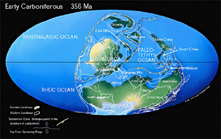
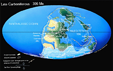
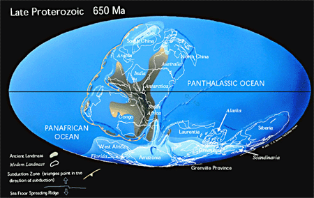
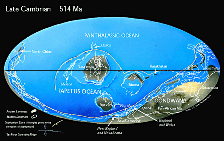
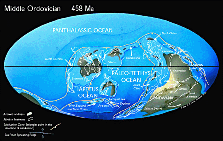
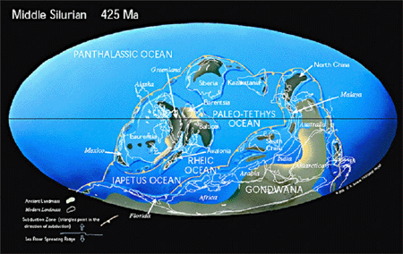
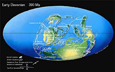
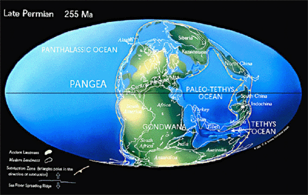
Maps and animations are available on the C. Scotese's Website
|
Figures
: Paleozoic paleogeographic maps (Scotese, 2000)
|
|||
