White Mesa mapping project
Partie rédigée
par Thomas bryant
On May 27th and 28th, we went to map in the White
Mesa area. White Mesa is located on a federal land (BLM - Bureau of Land Mangement)
and is open to the public (most pueblos and reservations are not open to the
public). It has a very hot climate with almost no vegetation
(even cactuses seem to find it tough to survive there) and apart for
rattlesnakes the only animals we saw were one antelope and a few cows (how on
earth do they survive there???). White Mesa is near a gypsum quarry situated to
the West/ North West of San Ysidro and about to the
south west of the Valles Caldera (Map figure 2). This geological site is West
of Santa Fe (about one hour by car). It’s
highest point is at about 6060 feet
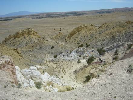
Figure: View of the south canyon of White Mesa
(looking south).
The objective of this project was to obtain the map of this area
containing Mesozoic sedimentary rocks and to study about canyon structures.