Visit of the search center of
seismology : IRIS PASSCAL
by Jérémie RUEST and Gwenaël
CARRER
On May 31th, we have been visiting the Socorro science faculty (New
Mexico tech) where is established a center of seismology named IRIS PASSCAL (Incorporated Research Institutions for Seismology).
This is an university research consortium dedicated to exploring the
Earth's interior through the collection and distribution of seismographic data
(http://www.iris.edu).
Thirty four people works here. Four missions in
progress. Sixty experiment per year.
First, Bruce Beaudoin, the manager of theLlaboratory, made a speech to introduce the visit. He showed the geographical localisation of the different permanent stations who receive the earthquake waves:
-
In United States of America,
New Mexico and the west coast is very equiped
-
In Africa, the east african
rift is under surveillance
-
In Asia, the Himalayas host
many instruments
-
In Europe, IRIS settled
survey instruments in The Apennines
-
Few instruments are settled
in Indonesia, in the Arabian peninsula and in Antartica.
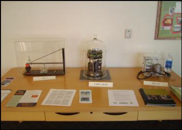
Then, Rick Aster (geophysic professor) showed us different seismometers
like AS-1, CMG-3ESP, CMG-40T, HS-10, L28, L22, STS 2, EpiSensor (Figure 1a) and
the CTBT (Figure 1b). This last one is the permanent station used by the
seismological center. It is able to measure only the wave who has the
caracteristical earthquake wavelength.
a)
EpiSensor L28 L22 STS-2 CMG-40
T CTBT AS-1 CMG-3ESP HS-10

Figure 1 : Seismological sensors used by IRIS PASSCAL
The seismometers a) are movable while b) is a permanent station. We can
see that CTBT has solar panel to work.
In figure 1a), there is an evolution
in time of the seismometers: the first used is AS-1 and the next ones are more
and more improved.
 b)
b)
After, Bruce Beaudoin presented a geophone warehouse where thousand of units are stored. Then, we went to see a little room where the geophones are tested and near we have discussed with a seismometer repairer. He said that a sensor cost about few ten thousand dollars.
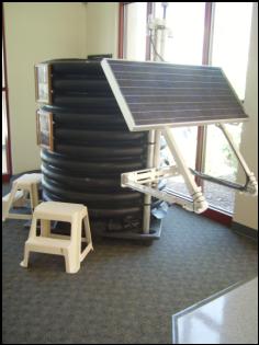
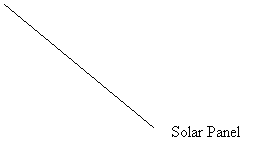
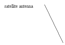
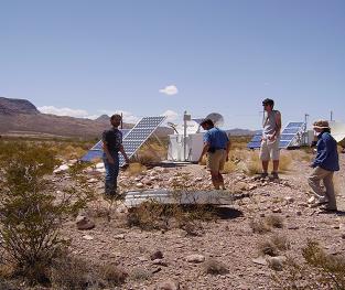
Finally, We gone outside to see a permanent station in activity (Figure
2). It was under the alluvial ground and connected with a GPS (Global
Positionning System) and solar panels. Near, there was a satellite antenna.
Figure 2 : Permanent station installed near the research
center. One of the interest is to allow for the survey of Sorocco area, where a
magma chamber is supposed to be active at depth.


We had two hours waiting a conference so we gone to a
library about the geology. Then, we visited their mineral museum who looks like
the museum of Crozon (France, Brittany) but more little of course!!!!!!!
Conference by Rick Aster : « Exploring the earth with seismology »
This conference appeared in a meeting room of the Socorro science
faculty.
He spoke about the earthquake: how it occurs and what happens in the rocks when it occurs (the elastic rebound for example). Then, he gaved a definition of the seismology (source, propagation, receiver) and a little animation of seismometer with different wavelength. The applet simulates a seismometer's reaction to an adjustable ground motion (see the website dedicated to this). He said that the waves are sensitive to elastic and density changes and their relation with the interior of the planet. The mantle and its convection was implicated here.
The Rio Grande rift was maybe due to the subduction of Farallon plate under the North American plate. The uplift rate is estimated to be 2,4 mm/yr at Socorro. Under the rift, the uplift rate is 2mm/yr so there is basatic volcanism. The different moho levels are : 35 km in the center of the rift, 42-45 km in the West and 45-50 in the East.