MD03-2493 / Cap Breton
Introduction
During the second part of the SEDICAR mission, the first core (core number MD03-2693) have been carried out in front of the CapBreton (Lat 43o 39.258N and Lon 01o 39.805) in the Bay of Biscay (figure 1). The depth of sea floor at the site is 431 m and 39.33 m long core sample was retrieved successfully which was carried out using CALIPSO corer in the Marion Dufresne.
Background information on Capbreton canyon
The canyon of capbreton, located in the gulf of Gascogne, is one of the deepest submarine canyons in the world. It has been known and studied for more than one century and has been the subject of several missions in 2000 and 2001 (SEDICAN 1 and 2, Itsas 2, 4 and 5) which have allowed the study of processes that govern terrace formation. From earlier studies like bathymetric map, seismic reflexion and cores (Interface and Kullerberg), three kinds of terraces morphology have been established. They are horseshoe-shaped terraces, flat terraces and terraces with pad.
Sedimentary processes in the area are gravity gliding (creeping, slumping, turbidity currents) and hemipelagic sedimentation which cover terraces. Horseshoe-shaped terraces come from abandoned meanders by flow of turbidity currents. Flat terraces and levees built on meander lobes and levelled by high hemipelagic sedimentation. Terraces with pad have been formed through the edification of levee through gravity gliding (creeping, slumping).
Study of seismic reflection data shows deposit stage and sedimentation break. Aquisition of additionnal data would allow establishing a chronology of the terrace formation. Moreover, the hypothesis on the sliding of the terraces that became unstable after lower terrace formation might be area of interest.
Objective of this coring
The main objectives of the core are to verify the hypothesis of the confined levee. In addition, the core will also allow finding the turbidity sequences, and make a datation of this events, in the way to understand the sedimentology of the aera.
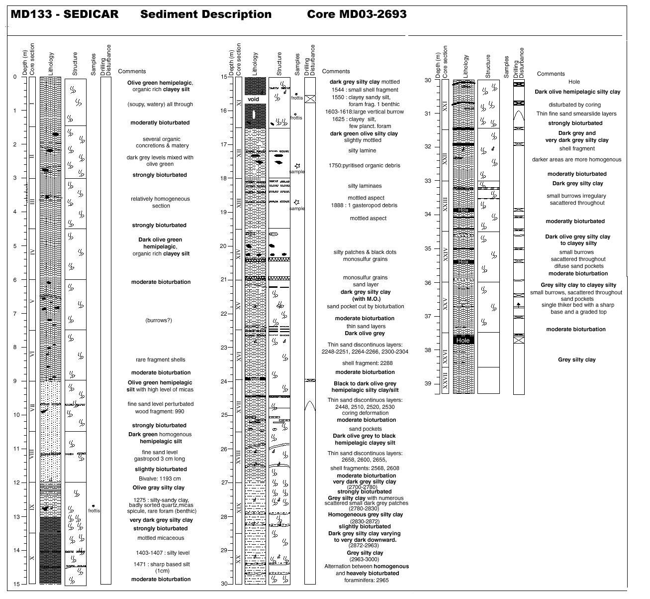
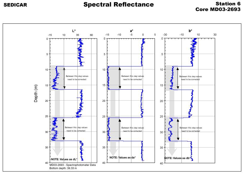
The techniques used in this work are the MST and the spectrophotometry, and each peaces of core are discribed so as to make a lithostratigraphic sediment description (core file, figure 2).
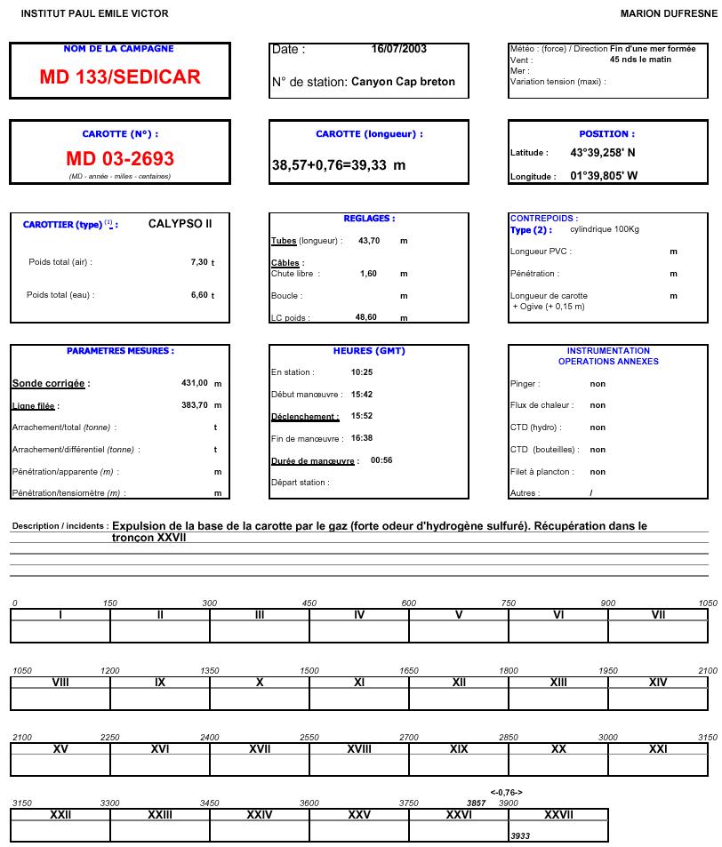
Objectives and Description of the Core 1 (MD 03-2693)
The main objectives of the core were:
- To know the types of formation and the terrace abandonment; and
- To date the sedimentary sequence
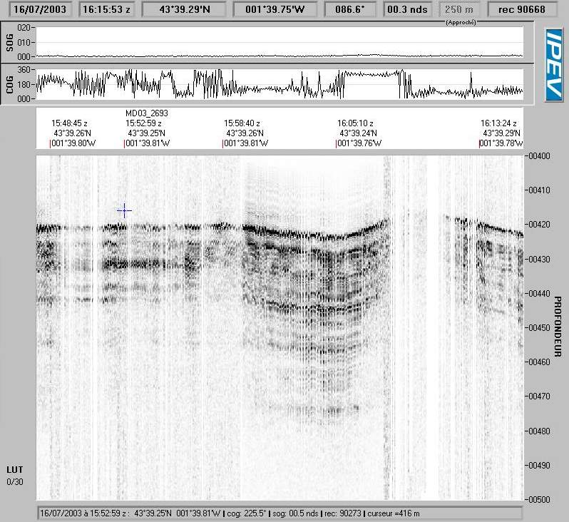
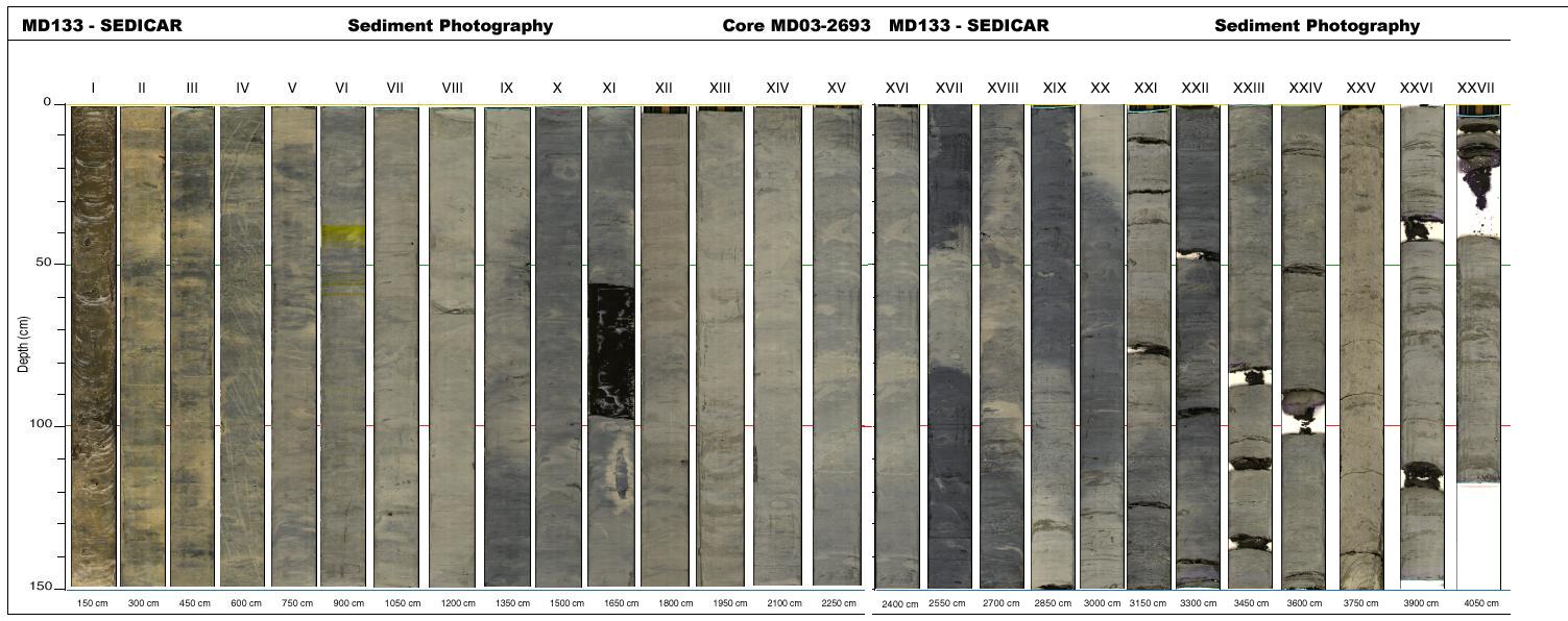
From 0-9 m below from sea surface, clayey silt with organic materials is observed. Then mica bearing silt was observed up to 12 m depth which gradually changed into dark colored silty clay. From 16 m to 39 m, mainly greenish colored silty clay was observed with frequent bioturbation and occasional sand pockets. Detailed litho-log of the core is shown in figure 3. Similarly, figure 4 and figure 5 shows spectral reflectance and 3.5 KHz profile respectively at the site.
