Pédagogies actives et formations dans un cadre international
Sont présentées ici plusieurs actions pédagogiques auxquelles j'ai participé, menées dans un cadre national ou international, dans les cursus ou hors cursus, visant à mettre les étudiants en position active (participation, approche-projet, restitutions, enquêtes, créativité, dialogue réflexif) et à enrichir l'approche pédagogique et culturelle.Module SEA-EU Développement Durable et Responsabilité Sociétale
Dans le cadre de l'Alliance européenne SEA-EU, une Unité d'Enseignement (UE) est offerte depuis la rentrée 2022 à tous les étudiants de 1ère année de l'UBO, visant à renforcer leur identité européenne, réussir leur transition numérique et co-construire des actions en faveur du développement durable. Cette UE est programmée au second semestre de l'année universitaire. Un module de cette UE est consacré aux questions de “Développement Durable et Responsabilité Sociétale”: il vise à nourrir la réflexion des étudiants sur une nouvelle trajectoire pour notre planète et notre société et à repenser ce qu’est une "vie réussie", sans moralisme, dogmatisme ou défaitisme, mais avec lucidité et dans un esprit d’ouverture et d’échange. Il a été construit par des enseignant.es des différentes composantes de l'UBO, en s'inspirant d’un ouvrage collectif, le Manuel de la Grande Transition. Il est organisé selon 6 portes d'entrée permettant de:
Adélie Pomade Yves-Marie Paulet Betty Queffelec Julien Hay Bénédicte Havard Duclos Guillaume Roullet Myriam Nourry Magali Prost Thierry Michot Marie-Noëlle Chalaye-Toueix Jacques Déverchère
- découvrir l’état actuel de notre planète (Planète Commune)
- mesurer les enjeux et identifier les acteurs-clés du développement durable (Mesure et Régulation)
- questionner la nature et imaginer une nouvelle organisation commune plus harmonieuse (Ethique et société)
- comprendre comment notre imaginaire peut impacter nos capacités d’action en faveur du développement durable (Récit),
- identifier les possibilités d’action (Agir)
- évaluer nos capacités de résilience, de reconnexion à la nature et aux autres (Résilience)
Adélie Pomade Yves-Marie Paulet Betty Queffelec Julien Hay Bénédicte Havard Duclos Guillaume Roullet Myriam Nourry Magali Prost Thierry Michot Marie-Noëlle Chalaye-Toueix Jacques Déverchère
PIM IA-G: Intelligence artificielle générative
- PIM: Projets Interdisciplinaires Mutualisés, Unité d’Enseignement ISblue lancée en janvier 2023, permettant d’aborder des questions complexes et transversales par formats d’apprentissages actifs et collaboratifs. Les étudiant·es, provenant des différentes mentions ISblue de l’UBO et l’UBS et des écoles d’ingénieurs partenaires (ENSTA Bretagne, IMT Atlantique, ENIB, Ecole Navale), choisissent une activité du catalogue proposé dans leur cursus et se consacrent à celle-ci pendant 5 jours (format modulaire).
- IA-G: Explorer le sujet des Intelligences Artificielles Génératives pour les sciences avec un œil critique (voir Page livrable PIM IAG & Sciences 2024). Ce PIM a été lancé pour la première fois en janvier 2024. Les Intelligences Artificielles Génératives fascinent autant qu'elles effraient dans le monde professionnel comme dans celui de la recherche scientifique. Cette technologie a le potentiel de transformer notre façon de travailler, en nous permettant d'interagir avec les machines de manière plus intuitive que jamais. À travers différentes interventions de chercheur·es et des exercices pratiques, les étudiants ont cherché les meilleures façons d'interagir avec ces outils et ont exploré les implications éthiques, les biais potentiellement préjudiciables et les défis sociaux que ces outils peuvent engendrer. On été mis en œuvre par groupe des tests sur des sujets scientifiques amenant à un examen critique des réponses de l'IA générative en tentant de détecter les biais et "hallucinations". A l'issue du PIM, a été produit un guide de bonnes pratiques de l'utilisation de l'IAG, accessible gratuitement.
Jean-Marie Gilliot Arnaud Agranier Jacques Déverchère
Réalité Virtuelle et réalité augmentée: Ateliers immersifs sous-marins (AISMERALDA) - ImmerSea LAB
- AISMERALDA: Cette expérimentation "AISMERALDA (Ateliers Immersifs Sous-Marins et Réalité Augmentée: Littoral, Dorsales, Autres)", menée avec des collègues de géosciences, géographie, biologie, chimie, économie, dans le cadre de l'EUR ISblue, vise à promouvoir l'utilisation de la réalité virtuelle ou augmentée dans différentes disciplines des Sciences de la Mer et du Littoral afin de mener une véritable expérience de formation "immersive" sous la mer ou sur les rivages. Une large autonomie est offerte aux apprenants au cours de l'apprentissage. L'objectif est d'élaborer des contenus pédagogiques et scientifiques s’appuyant sur des environnements immersifs et de les mettre en oeuvre dans l'offre de formation des Masters.
- IMMERSEA'LAB: Ce projet vise au développement d’environnements virtuels au service de la connaissance des océans, depuis le lycée jusqu’au niveau de l’enseignement supérieur. Il est soutenu par la Fondation Dassault Systèmes qui propose des solutions collaboratives de 3D et réalité virtuelle (plateforme 3DEXPERIENCE). Ce projet prolonge l'expérience AISMERALDA et s'inspire de la réussite du centre d'innovation GéoLab de l'Institut Polytechnique UNILASALLE, qui est un espace à vocation pédagogique dédié à l’innovation et la recherche en géosciences. Il a pour objectifs de: (1) proposer une démarche de pédagogie active et novatrice aux apprenants, (2) favoriser la collaboration d’expertises pluridisciplinaires entre étudiants, scientifiques et formateurs, (3) renforcer la valorisation pédagogique des données de campagnes scientifiques, (4) rendre accessibles à tous des environnements sous-marins ou côtiers qui ne le sont pas, et (5) permettre le développement de compétences transversales.
Licence 3 UBO: Connaissances en géologie et recherche documentaire
Comment bien se documenter sur les thématiques des géosciences? Depuis 2017, cette Unité d'Enseignement de 22h permet de mener différentes expériences d'utilisation de ressources (articles scientifiques, synthèse de revues, médias) afin de donner une vision ouverte, interdisciplinaire et diversifiée, des grands thèmes des Sciences de la Terre et de ses débouchés, de permettre aux étudiants de gagner en autonomie de recherche documentaire, et de mieux savoir dialoguer et présenter des résultats par écrit et par oral. Les thèmes changent chaque année et portent notamment sur les relations entre géologie, histoire, société, économie, et sur les liens entre géosciences et transformations socio-écologiques. Les analyses et restitutions orales se font alternativement par groupes de 2, 3 ou 4 étudiants, ou bien seul, et sont suivies systématiquement d'un temps d'échange entre les étudiants. Des posters sur des personnalités scientifiques récompensées par des prix en sciences de la Terre sont réalisés chaque année.
Master 1 IUEM: Universités Flottantes sur les navires hauturiers
Cette UE de Master 1 "Université Flottante" est une formation optionnelle en mer qui laisse une large place à la prise d'initiative des étudiants embarqués (voir la page Web présentant les différentes opérations menées et les réalisations par les étudiants).
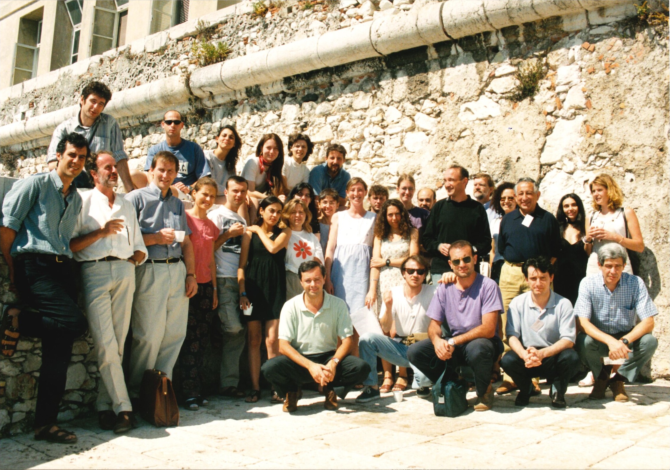
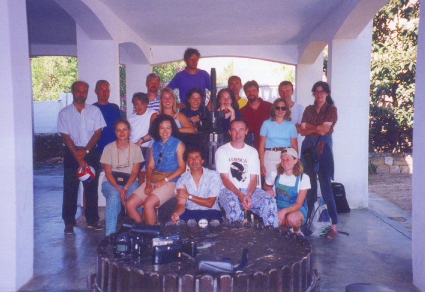
PhD Advanced Study Course - Marine Science and Technology Programme - July 1998 - Villefranche/Mer
This Training Course called "Insights on the formation and evolution of Mediterranean basins" took place in Villefranche-sur-Mer but also at sea (R/V Tethys) and on land in Corsica, from July 6 until July 27, 1998. It was funded by the European Commission in the frame of the MAST (Marine Science and Technology) Programme. Here is a brief summary of the Course which was among the best teaching experience I got in my whole carrier, thanks to the fantastic energy of the group of students and to the high quality and kindness of all the teachers/speakers.
This Advanced study Course aimed at providing to advanced level students and young scientists:
Twenty-four applicants have attended this part of the Course among the 25 first selected. The most prominent aspects of this cycle of lectures were the following:
• The references to processes observed in other oceans have been a great help for most students, especially when it was necessary to make comparisons with Mediterranean margins and to discern their specificities and peculiarities. They have also allow the audience to revise the necessary background vocabulary and concepts, which was obviously needed owing to the heterogeneity of the student group.
• The key concept of slab detachment as a driving mechanism for explaining complex surface deformations in the Western Mediterranean has been widely presented and discussed, sometimes during severe debates between some speakers. It has been the opportunity for students to be aware that, especially in the Mediterranean case, there is not an established,"pre-build", scientific truth, but instead a necessary and permanent interaction between geological-geophysical evidences and modelling or conceptual approaches which tend to reconcile them. Most lecturers have payed attention to the fact that these debates should involve all the audience: questions from students to lecturers, during and after the lectures, were always enhanced.
• An informal presentation of all participants by themselves has been proposed in the first day of the Course. Furthermore, the 4 presentations of students by short talks (Susan Buiter, Sharon Duermeijer, Netherlands) or posters and movies (Natalia Diaz, Spain, and Elena Konstantinovskaia, Russia) have allowed a quick and direct contact between lecturers and applicants at the beginning of the Course.
• A general discussion and summary have been sollicitated at the nearly end of the Lecture session (Saturday 11, July, afternoon) by students, and have brought many benefits (mostly, the opportunity for students to come back to points that were unclear, or too quickly described, and for lecturers, to develop links between several different lectures, resolve some ambiguities or apparent contradictions, and precise the still difficult unresolved questions). It appeared that if the hypothesis of slab detachment provides a highly attractive explanation to recent deformations observed in the Apennines and in North Africa, the exact timing between collisions and extensions, the cases of the Alboran sea and the "Ligurian knot", remain unclear and more controversial, as well as the exact balance between Africa-Europe convergence, slab pull changing with time, and gravitational collapse of mountain belts.
The field trip has been directed and organized by Prof. Laurent Jolivet (Paris 6 University) together with Dr. Marc Sosson (CNRS, Nice). A 100-page book has been prepared as a guide for this trip (see Annex 2). Twenty students have participated to this part of the Course, because 4 applicants selected declared the impossibility to stay for this part (either for health reason (pregnancy), or for work time schedule incompatibilities, or for personal reasons).
The field excursion was planned this way: each student has three continuous daily trips in the areas of Cape Corse, Balagne, Tende Massif. This was enough to allow students to observe in details the outcrops at various scales, the types of deformation, and the implications in terms of Pressure-Temperature paths and geodynamic evolution. The diversity of observations in a limited area offered the opportunity to analyse the effects of the Alpine and post-Alpine deformation history, from Eocene to present, and to understand the importance of the mechanisms that have brought to the surface high-pressure rocks (mainly, a first compressive stage of overthrust of Alpine Nappes over Crystalline Corsica, followed by a stage of extensive shear reworking the previous tectonic event, creating a detachment). Thanks to the evolutional history that could be observed and analysed on the field, it was possible for students to better understand the roles of plate boundary conditions (convergence of Africa, roll-back of the Tethys subduction zone) and of rheological, intrinsic, lithospheric properties (gravity potential, inherited structures, thermal, geometrical and petrological properties of various lithospheric layers of interacting microplates) in the deformation process of the area.
A careful methodological approach of these key tectonic events at various scales (from the crystal sample up to the whole lanscape) has been one of the major goal of this field study. Two synthetic cross-sections summarizing the main steps of deformation from Balagne to Eastern Cape Corse have been proposed as a conclusion for this part, which helped to make links and to further discuss the models presented during lectures.
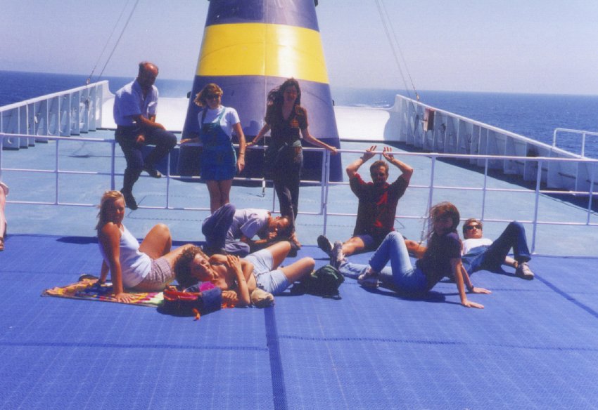
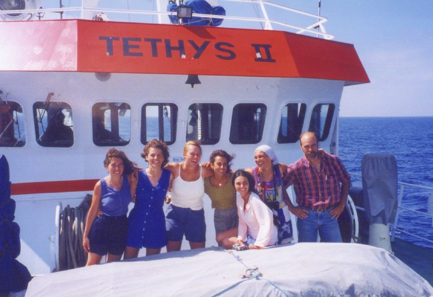
The cruise was directed by Jacques Déverchère. On Saturday 11, a short talk (see sea-cruise book, Annex 3) has introduced students to the main principles of marine seismics, with a special emphasis on the source used (air gun Bolt 40 ci) and the factors controlling the bubble pulse which shapes the seismic signature. Each group of 10 students at sea was in charge of the control of navigation and seismic acquisition. Each cruise began with a discussion in order to determine where to implement the profiles and what parameters of acquisition to choose (velocity, direction, shot interval, recording length, frequency bandpass, source volume, pressure, depth of gun and streamer, etc...). The choice was made according to two main parameters:
• the wish to recognize the offshore prolongations of structures and units observed on land;
• the sea conditions, which sometimes imposed to revise our choice of sections.
Each group has made a long (several tens kilometers) line with deep penetration (1.5 km) and medium resolution in order to observe structures at large scale (and more specifically, to try to image an important sea-mount of unknown nature which is in the prolongation of the Tende Massif, on the western side of the Saint-Florent Canyon: the so-called "Mont Glangeaud"). Furthermore, several short, high-resolution lines were done across the Saint-Florent gulf, which aims at following the Tende Massif detachment contact, the "Schistes Lustrés" nappes, and the tilted Miocene deposits. A total amount of ca. 120 km of seismic sections was done during the sea cruise by the student teams.
The last part of the Course aimed at introducing in a practical way:
• the basic concepts in seismic reflection analysis (mostly filtering, stacking, and migration), in order to give a realistic estimate on its importance in seismic imaging (see « Guide for seismic data Processing », Annex 4);
• an interpretation of the seismic sections obtained at sea, complemented by previous lines acquired in the same area (see general map and booklet provided), in order to get aware of the interests and limits of two-way traveltime lines, subsequent line-drawings, and structural maps deduced from ties between them (see Annexes 2 & 5).
Both parts have brought conclusive remarks and important insights, for instance on the importance of an accurate scale observation before interpretation, the weight of seismic processing in the "feeling" we have in front of a seismic image, the numerous tramps to avoid with artifacts (multiples, hyperbolas, pull-up and pull-down effects, etc...). The exercise of recognition and interpretation of seismic facies was especially important: it has been made possible thanks to the informations brought by Marc Sosson about the dives made recently in this area, and to the informations from outcrops in Balagne, Cape Corse, and Saint-Florent area, obtained by students during the field trip. A final discussion has led the groups to propose several new interpretations of offshore structures, for instance that the "Mont Glangeaud" sea-mount should be a granitoide promontory of the continental crust, shaped during the Messinian Salinity Crisis, and representing the seaward footwall of a detachment fault (thrust during the Alpine orogeny) equivalent to the Tende Massif shear zone observed on land (Annex 1).
The following objectives of the Course have been reached:
• giving in a short time an up-to-date review of the fundamental concepts leading to the formation of basins in the Mediterranean sea ;
• understanding recent processes affecting them, thanks to complementary methodological approaches and objects;
• making strengthfull links between offshore and offshore observations (which is obviously needed to understand the driving mechanisms of Neogene deformation) ;
• providing to applicants personal and direct opportunities and practical means and tools to correctly observe, describe, analyze and interprete geological (field outcrops) and geophysical (seismic images) data.
No particular practical problems appeared during the Course: the means provided for accommodation, meals, teaching rooms, refreshments, travels for lecturers, consumables, field trip in Corsica, transportation to Corsica, thanks to the European Commission, and ship facilities and teaching equipment, thanks to CNRS and "Geosciences Azur", have been qualified as convenient and appropriate by most participants.
Our feeling after the Course is that all participants (either applicants or lecturers) have appreciated and enjoyed the way it was, and what they have lived together. It was a great pleasure to feel the actual good harmony between participants during the whole Course.
The Organizing Committee thanks the European Commission to have made this Course possible and would like to underline how important it is in their opinion to go on favoring in Europe the contacts between advanced level students, who appreciate very much to meet and share scientific observations and objectives.
At the end of this fruitful Advanced Study Course, I would like to address my warmest thanks to the many people who have made this Course possible and successful, and especially Prof. Jacques Soyer, Director of Villefranche/Mer Observatory, who has stimulated the proposal, Edith Robertson, Secretary of the Course, the staff of « Géosciences Azur » Laboratory, under the supervision of Jocelyne Gosselin, the staff for accommodation and restaurant in the Observatory, led by Chantal Cettour, the staff for European Affairs in DR20 CNRS, Sophia Antipolis, led by Béatrice Saint-Cricq, and Elisabeth Lipiatou in DG12, Brussels.
Jacques Déverchère, UPMC Assistant Professor
Director of the Course
On behalf of the Organizing Committee
Villefranche/Mer, September 27, 1998
Teachers involved:
Giovanni Bertotti Gilbert Boillot Miquel Canals Alexandre Chemenda Georges Clauzon Claudio Eva Claudio Faccenna Paolo Gasparini Laurent Jolivet Enzo Mantovani François Michaud Laurent Royer Françoise Sage Bruno Savoye Giulio Selvaggi Marc Sosson Tamas Toth Anthony Watts Tamas Toth Marjorie Wilson Rinus Wortel
Students involved:
Patricia Barcenas Gianluca Bianchini Susanne Buiter Barbara Castello Maria Grazia Ciaccio Francesca Cifelli Pasquale De Gori Raffaele Di Stefano Charon Duermeijer Elena Eva Maria del Carmen Fernandez-Puga Francesca Funiciello Elena Konstantinovskaia Hélène Le Fur Maria Teresa Mariucci Massimo Musacchio Dimitris Sakellariou Yonathan Shaked Caterina Tamburelli ... Marcello Viti
Introduction
- an up-to-date review of the processes governing the Neogene formation and evolution of Mediterranean basins;
- a direct observation of remnants of successive phases of deformation during this history, as evidenced in Alpine Corsica;
- a full practical seismic survey at sea followed by a practical processing and analysis, in order to complement and generalize field geological observations.
Lectures in Villefranche/Mer
• The references to processes observed in other oceans have been a great help for most students, especially when it was necessary to make comparisons with Mediterranean margins and to discern their specificities and peculiarities. They have also allow the audience to revise the necessary background vocabulary and concepts, which was obviously needed owing to the heterogeneity of the student group.
• The key concept of slab detachment as a driving mechanism for explaining complex surface deformations in the Western Mediterranean has been widely presented and discussed, sometimes during severe debates between some speakers. It has been the opportunity for students to be aware that, especially in the Mediterranean case, there is not an established,"pre-build", scientific truth, but instead a necessary and permanent interaction between geological-geophysical evidences and modelling or conceptual approaches which tend to reconcile them. Most lecturers have payed attention to the fact that these debates should involve all the audience: questions from students to lecturers, during and after the lectures, were always enhanced.
• An informal presentation of all participants by themselves has been proposed in the first day of the Course. Furthermore, the 4 presentations of students by short talks (Susan Buiter, Sharon Duermeijer, Netherlands) or posters and movies (Natalia Diaz, Spain, and Elena Konstantinovskaia, Russia) have allowed a quick and direct contact between lecturers and applicants at the beginning of the Course.
• A general discussion and summary have been sollicitated at the nearly end of the Lecture session (Saturday 11, July, afternoon) by students, and have brought many benefits (mostly, the opportunity for students to come back to points that were unclear, or too quickly described, and for lecturers, to develop links between several different lectures, resolve some ambiguities or apparent contradictions, and precise the still difficult unresolved questions). It appeared that if the hypothesis of slab detachment provides a highly attractive explanation to recent deformations observed in the Apennines and in North Africa, the exact timing between collisions and extensions, the cases of the Alboran sea and the "Ligurian knot", remain unclear and more controversial, as well as the exact balance between Africa-Europe convergence, slab pull changing with time, and gravitational collapse of mountain belts.
Field trip in Corsica
The field excursion was planned this way: each student has three continuous daily trips in the areas of Cape Corse, Balagne, Tende Massif. This was enough to allow students to observe in details the outcrops at various scales, the types of deformation, and the implications in terms of Pressure-Temperature paths and geodynamic evolution. The diversity of observations in a limited area offered the opportunity to analyse the effects of the Alpine and post-Alpine deformation history, from Eocene to present, and to understand the importance of the mechanisms that have brought to the surface high-pressure rocks (mainly, a first compressive stage of overthrust of Alpine Nappes over Crystalline Corsica, followed by a stage of extensive shear reworking the previous tectonic event, creating a detachment). Thanks to the evolutional history that could be observed and analysed on the field, it was possible for students to better understand the roles of plate boundary conditions (convergence of Africa, roll-back of the Tethys subduction zone) and of rheological, intrinsic, lithospheric properties (gravity potential, inherited structures, thermal, geometrical and petrological properties of various lithospheric layers of interacting microplates) in the deformation process of the area.
A careful methodological approach of these key tectonic events at various scales (from the crystal sample up to the whole lanscape) has been one of the major goal of this field study. Two synthetic cross-sections summarizing the main steps of deformation from Balagne to Eastern Cape Corse have been proposed as a conclusion for this part, which helped to make links and to further discuss the models presented during lectures.
Cruise off Corsica
• the wish to recognize the offshore prolongations of structures and units observed on land;
• the sea conditions, which sometimes imposed to revise our choice of sections.
Each group has made a long (several tens kilometers) line with deep penetration (1.5 km) and medium resolution in order to observe structures at large scale (and more specifically, to try to image an important sea-mount of unknown nature which is in the prolongation of the Tende Massif, on the western side of the Saint-Florent Canyon: the so-called "Mont Glangeaud"). Furthermore, several short, high-resolution lines were done across the Saint-Florent gulf, which aims at following the Tende Massif detachment contact, the "Schistes Lustrés" nappes, and the tilted Miocene deposits. A total amount of ca. 120 km of seismic sections was done during the sea cruise by the student teams.
Seismic data analysis
• the basic concepts in seismic reflection analysis (mostly filtering, stacking, and migration), in order to give a realistic estimate on its importance in seismic imaging (see « Guide for seismic data Processing », Annex 4);
• an interpretation of the seismic sections obtained at sea, complemented by previous lines acquired in the same area (see general map and booklet provided), in order to get aware of the interests and limits of two-way traveltime lines, subsequent line-drawings, and structural maps deduced from ties between them (see Annexes 2 & 5).
Both parts have brought conclusive remarks and important insights, for instance on the importance of an accurate scale observation before interpretation, the weight of seismic processing in the "feeling" we have in front of a seismic image, the numerous tramps to avoid with artifacts (multiples, hyperbolas, pull-up and pull-down effects, etc...). The exercise of recognition and interpretation of seismic facies was especially important: it has been made possible thanks to the informations brought by Marc Sosson about the dives made recently in this area, and to the informations from outcrops in Balagne, Cape Corse, and Saint-Florent area, obtained by students during the field trip. A final discussion has led the groups to propose several new interpretations of offshore structures, for instance that the "Mont Glangeaud" sea-mount should be a granitoide promontory of the continental crust, shaped during the Messinian Salinity Crisis, and representing the seaward footwall of a detachment fault (thrust during the Alpine orogeny) equivalent to the Tende Massif shear zone observed on land (Annex 1).
Conclusions
• giving in a short time an up-to-date review of the fundamental concepts leading to the formation of basins in the Mediterranean sea ;
• understanding recent processes affecting them, thanks to complementary methodological approaches and objects;
• making strengthfull links between offshore and offshore observations (which is obviously needed to understand the driving mechanisms of Neogene deformation) ;
• providing to applicants personal and direct opportunities and practical means and tools to correctly observe, describe, analyze and interprete geological (field outcrops) and geophysical (seismic images) data.
No particular practical problems appeared during the Course: the means provided for accommodation, meals, teaching rooms, refreshments, travels for lecturers, consumables, field trip in Corsica, transportation to Corsica, thanks to the European Commission, and ship facilities and teaching equipment, thanks to CNRS and "Geosciences Azur", have been qualified as convenient and appropriate by most participants.
Our feeling after the Course is that all participants (either applicants or lecturers) have appreciated and enjoyed the way it was, and what they have lived together. It was a great pleasure to feel the actual good harmony between participants during the whole Course.
Acknowledgements
At the end of this fruitful Advanced Study Course, I would like to address my warmest thanks to the many people who have made this Course possible and successful, and especially Prof. Jacques Soyer, Director of Villefranche/Mer Observatory, who has stimulated the proposal, Edith Robertson, Secretary of the Course, the staff of « Géosciences Azur » Laboratory, under the supervision of Jocelyne Gosselin, the staff for accommodation and restaurant in the Observatory, led by Chantal Cettour, the staff for European Affairs in DR20 CNRS, Sophia Antipolis, led by Béatrice Saint-Cricq, and Elisabeth Lipiatou in DG12, Brussels.
Jacques Déverchère, UPMC Assistant Professor
Director of the Course
On behalf of the Organizing Committee
Villefranche/Mer, September 27, 1998
Annexes
- MAST'98 call lauched by the European Commission: MAST98 Call (0.3MB)
- ANNEX 1 : Programme and abstracts (with lists of participants): MAST98 booklet - pdf (3.2MB)
- ANNEX 2 : Field-trip guide book, by Laurent Jolivet: Part 1 - pdf (4.8MB) (introduction and geodynamic setting) - (excursion guide book)
- ANNEX 3 : Sea-cruise guide book, by Jacques Déverchère: Sea cruise - pdf (2.6MB)
- ANNEX 4 : Guide book for Seismic data processing, by Françoise Sage: Seismic data processing - pdf (6.3MB)
- ANNEX 5 : Guide book Preliminary stages for interpretation of seismic reflection profiles collected offshore the Corsica Island, by François Michaud: Seismic interpretation - pdf (1.2MB)
Teachers involved:
Giovanni Bertotti Gilbert Boillot Miquel Canals Alexandre Chemenda Georges Clauzon Claudio Eva Claudio Faccenna Paolo Gasparini Laurent Jolivet Enzo Mantovani François Michaud Laurent Royer Françoise Sage Bruno Savoye Giulio Selvaggi Marc Sosson Tamas Toth Anthony Watts Tamas Toth Marjorie Wilson Rinus Wortel
Students involved:
Patricia Barcenas Gianluca Bianchini Susanne Buiter Barbara Castello Maria Grazia Ciaccio Francesca Cifelli Pasquale De Gori Raffaele Di Stefano Charon Duermeijer Elena Eva Maria del Carmen Fernandez-Puga Francesca Funiciello Elena Konstantinovskaia Hélène Le Fur Maria Teresa Mariucci Massimo Musacchio Dimitris Sakellariou Yonathan Shaked Caterina Tamburelli ... Marcello Viti
Master 1 IUEM, Mention Géosciences: Terrain Terre-Mer avec les Universités de Purdue et Bucknell, Etats-Unis - 2003-2004-2005-2006
De 2003 à 2006, nous avons mis en place une série d'échanges annuels entre les formations de Master en Géosciences entre les Universités de Brest et de Purdue (Indiana, Etats-Unis). Ces échanges visaient à mettre en prise directe nos formations avec la recherche de terrain en développant la mobilité internationale des étudiants en Sciences de la Terre du Finistère, et ainsi à accroître notre attractivité nationale à l’occasion de la mise en place du nouveau système d’enseignement LMD.
Ce lien Echanges entre l'UBO et Purdue mène vers une page de présentation de l'action de formation. Le tableau suivant résume les opérations et offre un résumé des actions menées et des réalisations faites par les étudiants.
Enseignants impliqués:
Mary Beth Gray Eric Calais Chris Daniel David Graindorge Jean-Pierre Peypouquet Kenneth Ridgway Joël Rolet Jeffrey Trop
Ce lien Echanges entre l'UBO et Purdue mène vers une page de présentation de l'action de formation. Le tableau suivant résume les opérations et offre un résumé des actions menées et des réalisations faites par les étudiants.
| Opération de formation | Année | Lieu de formation | Partenaires impliqués |
| Université Flottante PICABIA + SEDICAR | 2003 | A bord du N/O Marion Dufresne (Atlantique) | UBO-IUEM, Purdue University, Université de Bordeaux |
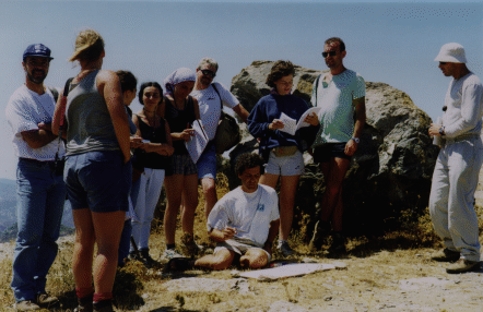
| Transect géologique Denver-Los Angeles | 2004 | De Denver (Colorado) à Los Angeles (Californie) | UBO-IUEM, Purdue University |
| International Training Course in Marine Geosciences | 2005 | Brest, Crozon, Mer d'Iroise | UBO-IUEM, Purdue University |
| Transect géologique Santa Fe-Socorro | 2006 | De Santa Fe à Socorro (Nouveau-Mexique) | UBO-IUEM, Purdue University, Bucknell University |
Enseignants impliqués:
Mary Beth Gray Eric Calais Chris Daniel David Graindorge Jean-Pierre Peypouquet Kenneth Ridgway Joël Rolet Jeffrey Trop